Frequently Asked Questions
About VRT Solutions
Dual EM and Gamma Radiometric
Precision Agriculture
About
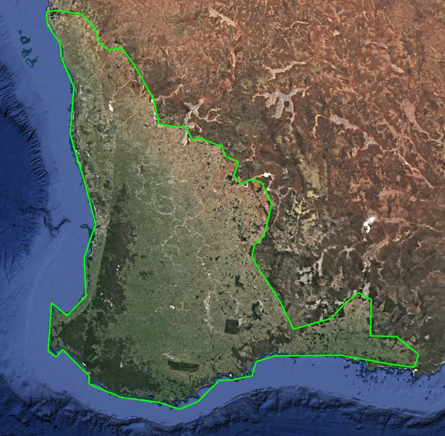
Where do VRT Solutions operate?

Dual EM and Gamma Radiometric Experts
How much does a soil survey cost?
- Cost-effective Implementation
- Rapid ROI
- Enhanced Input utilisation
VRT Solutions has worked hard to keep the costs of investing in this technology low on a per-hectare basis. Generally, adoption of this technology can potentially pay back in savings and higher efficiency of inputs within one to two years, with everything after that becoming a reward for adoption.
What is an EM and gamma radiometric survey?
- DualEM surveys for salt, soil texture, moisture
- Gamma radiometrics for soil texture, sand and rock identification
- Combined analysis enhances soil identification
Dual EM surveys are undertaken by VRT Solutions to measure soil electrical conductivity allowing soil variability to be mapped. The EM probe consists of horizontal and vertical electromagnetic fields that collect data simultaneously.
What does EM38 refer to?
- EM38 Instrument: The Geonics EM38, a lightweight geophysical surveying tool, is popular for EM mapping due to its ease of use
- Range of EMI Sensors: VRT Solutions employs different EMI sensors, including DualEM 1s, DualEM 21s, and Geonics EM38 MKII
- Range of gamma radiation detectors: VRT Solutions has multi vehicle fleet fully capable of large scale gamma radiometric projects
Changes in EM readings across a typical paddock can be indicative of changes in salinity, clay percentage, and presence of moisture and metal or several of these factors at once! In Western Australia, gamma radiometrics is a necessary sensor which provides a complimentary dataset which is collected simultaneously. We use both sensors together due to the high prevalence of low EM soils in WA.
Precision Agriculture Experts
How much does data processing cost?
- Affordable data processing
- Versatile benefits
- Informed decisions
Costs of yield data, remote sensing and elevation data processing can be less than a dollar per hectare, depending on area. This data can assist in strategic farm planning, farm performance, evaluation of current on-farm practices, and improvement of struggling areas on the farm.
What is biomass imagery?
- NDVI Definition
- Calculation Basis
- Farming benefits or mistakes made
Normalised differential vegetation index (NDVI) is calculated by using a formula, looking at the reflectance of visible red light and near infrared light on green areas. Chorophyll in plant leaves has high absorbance of visible light, while leaf cells reflect near infrared light. If there is variability in the health of the crop, assessing the NDVI across a farm or paddock (of the same species and variety) can lead to better use of top up nitrogen applications, especially in a VR situation.
Soil Sampling and Testing Experts
Does it matter how soil sampling is done?
- Soil sampling method critical for success
- Targeted approach
- Informed decisions
The method of soil sampling is crucial for obtaining representative and actionable data. Targeted sampling, for instance, focuses on specific areas or zones within a field identified as unique or problematic. This approach provides detailed insights into localized issues, allowing for precise interventions.
What value does EM and Gamma Radiometric data add in combination with soil sample data?
- Cost effective predictive modelling
- Practical data solution
- Comprehensive method equals comprehensive results
EM and gamma data, through interpolated maps, offer the kind of predictive modelled coverage that would be far too expensive to conduct with soil sampling. Other methods and theories are available by other service providers, but we adopt a highly critical approach to our own methods, always striving to improve on an already efficient system.
What role does expert analysis play in interpreting data and building prescription maps?
- Balanced and unbiased review of VR prescription
- Expert advice, based on experience and non-emotive data
- Maximise your time and efficiency
Time and efficiency loss can be a major downside if the analysis is not properly conducted. If the data is misinterpreted, there could be a poor zoning map applied for a soil ameliorant product for example, that may not be required, or may be too much, leading to nutritional problems, poor ROI per hectare and wasted time and energy through logistics. Balance is required with variable rate prescriptions, it needs a reasonable approach while being mindful of the pitfalls, therefore experience is really highly sought after.